Recently we have purchased a pair of multispectral drones which allow us to carry out crop and land surveys, thus helping farmers, landowners and other agencies in identifying various different land, crop and infrastructure issues.
Our Mavic 3 Multispectral drones carry NIR cameras which detect light from a very specific range of the electromagnetic spectrum. As only some of this light will be absorbed when striking vegetation, we use the NIR detecting cameras identify vegetation and non-vegetation, and measure the relative health of crops and plants.
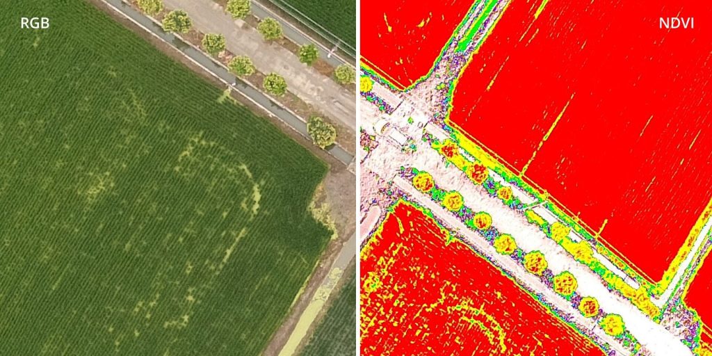
The data can then be massaged into a map to display a normalised difference vegetation index (NDVI), an image which clearly shows plant density and crop health. It is therefore a great tool for the agriculture industry to monitor growth speeds and detect areas of crop that are diseased or require fertiliser.
When NIR data detects relative changes in plant growth or disease, it can often act as an indicator not only about the vegetation but the condition of the ground underneath. For example, if something has been buried in a field causing the topsoil to be disturbed, the change in the soil will affect the plant growth and will show up in NIR surveys. Oscar Cymru has the knowledge and experience in conducting surveys to detect and identify both crop growth/disease on farmland and old infrastructure (underground storage tanks, pipelines) on construction and development sites.